During spring and summer storm seasons, it's important to stay informed about various weather phenomena, one of which is a derecho.
Despite being a common term among meteorologists, many people remain unaware of what a derecho is, its potential impact, and the signs one may be approaching.
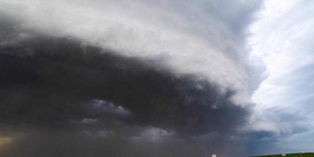
What is a Derecho?
A derecho (pronounced deh-REY-cho) is a widespread, long-lived wind storm associated with a band of rapidly moving showers or thunderstorms. Derived from the Spanish word for "straight ahead" or "direct," the term was first used in the meteorological context by Dr. Gustavus Hinrichs in the late 19th century to distinguish these straight-line wind events from the rotational winds of a tornado.
Derechos can span hundreds of miles and last several hours, making them some of the most destructive weather phenomena.
The key characteristic of a derecho is the extensive damage they can cause due to straight-line winds, which must reach speeds of at least 58 mph for a majority of their path but can often exceed 100 mph.
This extensive wind damage swath sets derechos apart from other wind events, and they can occur over a large area comparable to the size of several states.
Understanding the Impact of Derechos
Derechos can be incredibly destructive, often resulting in widespread property damage, power outages, and, unfortunately, sometimes, loss of life. Because of their scale and the intense winds associated with them, they can cause significant damage to infrastructure and natural landscapes.
Fallen trees, downed power lines, and extensive damage to buildings and vehicles are common in the wake of a derecho.
In addition to their immediate destructive impact, derechos can also have lasting effects. Power may be out for several days or even weeks, making it challenging to clean up debris or repair damage.
The aftermath can be comparable to the impact of a hurricane or tornado but over a much larger area.
Identifying a Derecho
So how can you identify an impending derecho? This can be challenging, as derechos often form rapidly and can catch people by surprise. Meteorologists monitor weather patterns closely for the telltale signs of a developing derecho, which can include intense heat and humidity, rapid changes in wind speed and direction, and severe thunderstorms.
If you hear a severe thunderstorm warning from your local weather station, pay close attention to further updates and instructions.
Forecasters might not be able to confirm that it's a derecho until it's already happening, but any severe thunderstorm has the potential to be dangerous and should be taken seriously.
Understanding derechos is the first step in preparing for their potential impact.
If you experience damage to your home or business from a derecho, you will need to understand how to navigate an insurance claim. You have the right to seek assistance from public adjusters in the aftermath of these powerful and destructive events.
Working with a public adjuster throughout your claim is your best opportunity for a more successful outcome. Our team of experts at Sill Public Adjusters has more advice on handling a derecho claim.
Stay informed, stay safe, and remember - knowledge is the first line of defense against the unpredictable power of Mother Nature.
Sill Public Adjusters are available 24/7 by calling 844.650.7455.